
Handheld mobile mapping applied to historical urban areas
Abstract
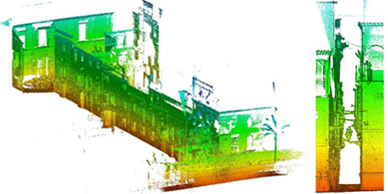
Mapping historical urban areas is an assignment that can be tackled by using different systems and devices. In the last decade many surveying systems have emerged in this this ever-evolving market. So, despite having a wide spectrum of options to choose, the decision-making is not an easy task. It depends on the budget, the training, the experience, the available delivery term, the specific features of the streets and buildings, etc. In this article a complete high-speed recording procedure, by using a handheld mobile mapping instrument to record a typical old town street, is going to be described. The aim is to enlighten the decision-making when choosing the appropriate methodology. The characteristics of this kind of streets, such as an extreme narrowness and accessibility difficulties make this type of areas more difficult to surveying. Additionally, a comparison between this procedure and stop-and-go systems will be carried out. The research shows that the graphical documentation obtained fulfils perfectly the initial requirements and the fieldwork has turned out much less time-consuming by using mobile mapping devices than standard stop-and-go laser scanning systems and photogrammetry procedures.
Keywords
Full Text:
PDFRefbacks
- There are currently no refbacks.
Copyright (c) 2018 José Antonio Barrera-Vera, José Antonio Benavides-López
DISEGNARECON
ISSN 1828 5961
Registration at L'Aquila Law Court no 3/15 on 29th June, 2015.
Indexed in SCOPUS. Diamond Open Access. All papers are subjected to double blind peer review system by qualified reviewers.
Journal founded by Roberto Mingucci