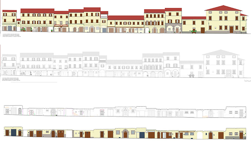
The historic centre of Poppi, an urban-scale analysis for assesment of seismic risk
Abstract
The town of Poppi as a case study to address the question of analysing historic centres in terms of their documentation, preservation and safety. The work was divided into three areas: the realization of a reliable survey, an appropriate reconstruction of the current state and the identification of the critical elements of the building fabric. The survey was carried out using 3D laser scanning technology to obtain high quality documentation of the artifacts and a graphic display able to show their architectural value. Cataloguing was used to gather the information needed to identify the building system. The question of safety was also addressed both through the analysis of street fronts to identify possible deformations, and by examining the inclination of the straight sides of the arcades. A thematic summary map was realized using this data system.
Keywords
urban survey; certification of the survey; drawing methods; plastic deformation; sismic safety; pillar inclination
References
Architect and research fellow in Surveying and representing architecture and the environment. Since 2016 RTDB Researcher at the Department of Architecture of the University of Florence, he also lectures on a regular basis at the ‘Euro-Méditerranéenne Université de Fès in the Euro-Méditerranéenne École d’Architecture et d’Urbanisme.
Refbacks
- There are currently no refbacks.
Copyright (c) 2017
DISEGNARECON
ISSN 1828 5961
Registration at L'Aquila Law Court no 3/15 on 29th June, 2015.
Indexed in SCOPUS. Diamond Open Access. All papers are subjected to double blind peer review process by qualified reviewers.
Journal founded by Roberto Mingucci
