
Potentiality of support technologies for opinion and decision-making as a tool for insertion of the geologist in territorial planning
Abstract
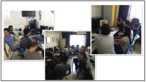
The Geodesign technique for which it is intended is an alternative exercise plan for a region of the Quadrilátero Ferrífero, in Minas Gerais, Brazil, using a Geology base such as. The geodesy workshop was developed for the mining and construction of a territorial plan for a region. This result is the Decision Model, which is consistent with a study area and has demonstrated that the method used is assertive to landscape and territory planning.
DOI: https://doi.org/10.20365/disegnarecon.20.2018.5
Keywords
Full Text:
PDFReferences
Ballal, H. Geodesign Hub. [201-]. Disponível em:. Retrieved February 22, 2018.
Campagna, M., Steinitz, C., Di Cesare, E., Cocco, C., Ballal, H. & Canfield, T. (2017). Collaboration in planning: the Geodesign approach. Rozwój Regionalny i Polityka Regionalna, 35, 55–72.
Campagna, M. (2013). Geodesign, sistemi di supporto al piano e metapianificazione. Disegnarecon, 6(11), 133–140.
Dangermond, J. GeoDesign and GIS – Designing our Futures. (2010). In: Buhmann, E., Pietsch, M. & Kretzler, E. (Ed.). Peer Reviewed Proceedings of Digital Landscape Architecture 2010 at Anhalt University of Applied Sciences. Wichmann, Berlin/Offenbach, 502-514.
Fonseca, B. M. (2015). Conceitos e Práticas de Geodesign Aplicados ao Ordenamento Territorial do Município de São Gonçalo do Rio Abaixo. Doctoral Dissertation. Universidade Federal de Minas Gerais, Belo Horizonte, 2015. Available in: . Retrieved February 22, 2017.
Fonzino, F. & Lanfranchi, E. (2017). The Application of the Geodesign Approach to an Italian Post-Earthquake Context. Master Dissertation, Aalborg University, 9 jun. 2017. Available in: . Retrieved February 22, 2018.
Kubler, G. (1973). Formes du temps: remarques sur l’histoire des choses. Paris, Champ Libre.
Malczewski, J. (1999). GIS and multicriteria decision analysis. New York, John Wiley & Sons.
MALCZEWSKI, J. (2006). GIS-based multicriteria decision analysis: a survey of the literature. International Journal of Geographical Information Science, 20 (7), 703-726.
Miller, W. R. (2012). Introducing Geodesign: the concept. Redlands, Esri Press. Available in: . Retrieved February 22, 2018.
Moura, A. C. M. (2014). Geoprocessamento na Gestão e Planejamento Urbano. Rio de Janeiro, Interciência.
Moura, A. C. M (2007). Reflexões metodológicas como subsídio para estudos ambientais baseados em Análise de Multicritérios. XIII Simpósio Brasileiro de Sensoriamento Remoto, Anais..., Florianópolis, INPE, 2899-2906. Available in: . Retrieved February 22, 2018.
Rivero, R., Smith, A., Ballal, H. & Steinitz, C. (2015). Promoting collaborative Geodesign in a multidisciplinary and multiscale environment: Coastal Georgia 2050, USA. In.: Buhmann, E., Ervin, S. M., Pietsch, M. (Ed.). Proceedings of Digital Landscape Architecture 2015. Berlim: Herbert Wichmann Verlag, 42-58.
Santos, M. (2006). A natureza do espaço: técnica e tempo, razão e emoção. 4. ed. São Paulo, USP.
Santos, M. (2005). A urbanização brasileira. São Paulo, Hucitec.
Simon, H. A. (2013). Administrative Behavior: a study of decision-making processes in administrative organizations. 4. ed. New York, The Free Press.
Steinitz, C. (2012). A Framework for Geodesign: Changing Geography by Design. Redlands, ESRI Press.
Vichas, R. P. (1982). Complete Handbook of Profitable Marketing Research Techniques. New Jersey, Englewood Cliffs and Pretice-Hall.
Word Clouds. Website. Available in: . Retrieved February 22, 2018.
Refbacks
- There are currently no refbacks.
Copyright (c) 2018 Pedro Benedito Casagrande
DISEGNARECON
ISSN 1828 5961
Registration at L'Aquila Law Court no 3/15 on 29th June, 2015.
Indexed in SCOPUS. Diamond Open Access. All papers are subjected to double blind peer review process by qualified reviewers.
Journal founded by Roberto Mingucci