Collaborative Mapping Through Social Networks as a Citizens’ Activism in the Discussions About Florianópolis’s Participative Master Plan
Abstract
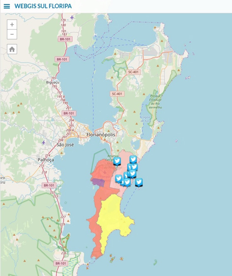
The web 2.0 generation stands out by the intensity of its users in the formation and interaction of the online content. Web platforms arise for the purpose of Collaborative Mapping, performing their function through the participation of citizens living in the environment to be collected the data, favoring the immersion of them in questions about the daily life where they reside. These applications improve the communication and perception of this "monitoring agent" around the place where they live. Therefore, this study demonstrates understanding the possibility of using twitter as another tool of cyberspace for urbanism, allowing the community to become an agent of participation in the discussions about its city - in the case analyzed, as an insight - to the instrument of urban planning called "Participative Master Plan of Florianópolis".
Keywords
Full Text:
PDFReferences
Balram, S. & Dragicevic, S. (2006). Collaborative Mapping and GIS: An Alternative Geographic Information Framework. Gillavry, M. (Ed.). In: Collaborative Geographic Information Systems, Idea Group Publishing, 103–119.
Borges, J., Jankowski, P., & Davis J., C.A. (2015). Crowdsourcing for Geodesign: Opportunities and Challenges for Stakeholder Input in Urban Planning. In: RobbiSluter, C., Cruz, C. B. M., Menezes, P. M. L. (Org.) Cartography - Maps Connecting the World. Switzerland: Springer International Publishing, 1, 361-373.
Borges, J., Jankowski, P. & Davis J., C.A. (2016). A study on the use of crowdsourced information for urban decision-making. Revista Brasileira de Cartografia (2016), 68(4), 695-703.
Bouskela, M., Casseb, M., Bassi, S., De Luca, C. & Facchina, M. IADB (BID) - Banco Interamericano de Desenvolvimento, (2016). Caminho para as smart cities: da gestão tradicional para a cidade inteligente / Copyright BID.
BRAZIL. Estatuto da cidade (2001) Estatuto da cidade: Lei n. 10.257, de 10 julho de 2001, e legislação correlata. – 2. ed. – Brasília: Câmara dos Deputados, Edições Câmara, 2009.
Câmara, G., Monteiro, A. M., Fucks, S. D. & Carvalho, S. (2004). Spatial Analysis and GIS: A Primer [Online]. Accessed in April 2015. p.1-30. http://www.dpi.inpe.br/gilberto/tutorials/spatial_analysis_primer.pdf
Goodchild, M. (2007). Citizens as sensors: the world of volunteered geography. GeoJournal, 69 (4), 211-221.
Jankowski, P. & Nyerges, T. (2001). Geographic information systems for group decision making. Towards a participatory, geographic information science. British Library Cataloguing in Publication Data.
Lévy, P. (2000). A inteligência coletiva: por uma antropologia do ciberespaco. 3.ed. São Paulo: Loyola.
Souza, M. (2010). Mudar a cidade: uma introdução crítica ao planejamento e à gestão urbanos. 6.ed. Rio de Janeiro: Bertrand Brasil.
Refbacks
- There are currently no refbacks.
Copyright (c) 2018 Eduardo Schmidt Longo, Rodrigo Pinheiro Ribas
DISEGNARECON
ISSN 1828 5961
Registration at L'Aquila Law Court no 3/15 on 29th June, 2015.
Indexed in SCOPUS. Diamond Open Access. All papers are subjected to double blind peer review process by qualified reviewers.
Journal founded by Roberto Mingucci
