
An Unpublished Cartography of Granada (Spain) From the Beginning of the XXTH Century: Bases for its data integration in a GIS
Abstract
Currently, the analysis, planning and management of cities and territories use some tools - nowadays nearly unavoidable - that are experiencing an extraordinary development in the last decades. All these tools are related to the Geographic Information Technology (GIT). With GIT we are talking about the Geographic Information Systems (GIS) and the Spatial Data Infrastructure (SDI).
Recent studies carried out about historical cartography are demonstrating that they are not beyond this trend. Many are the advantages on the use of these tools: the georeferencing of the information contained, the variety of geospatial analysis permitted, and above all, the dissemination which this information can experience through the SDI. These, are precisely the tools we want to use in the unpublished historical cartography of Granada. Nevertheless, this study is also concerned on proposing a methodology that will meet the former objectives. And will also take into account previous experiences on similar studies done on historical cartographies.
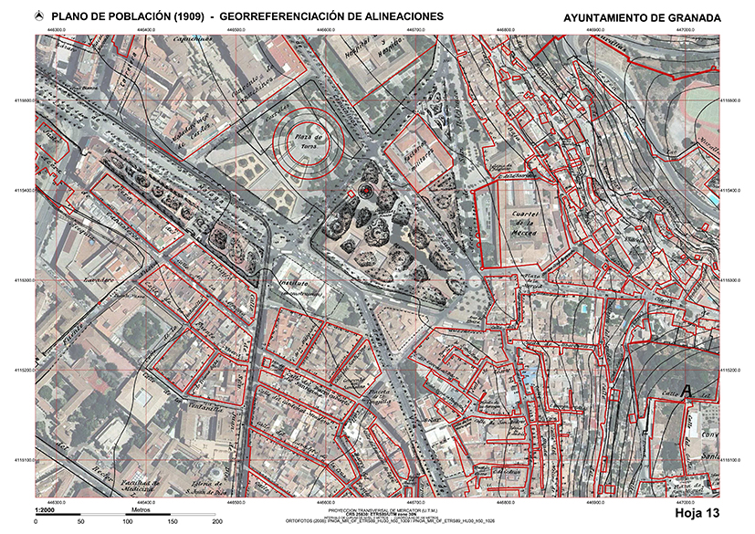
The aim of this study is to set the bases of a future Spatial Data Infrastructure (SDI), based on the Population Map of Granada, created at the beginning of the XXth century. This way, this cartography will be completed with an uncountable number of variables such as: urban, cultural, economic, socio-demographic variables, etc. All of which can be georeferenced, fact that will definitely help to have a bigger knowledge of the city at that time. This will be achieved by structuring, visualizing, publishing and sharing all the data of that time through this new information tools.
This work arises from a research that took place in SMlab UGR (Survey and Modelling Lab of Architectural Heritage), based in the Superior Technical School of Architecture, University of Granada.
DOI: https://doi.org/10.20365/disegnarecon.22.2019.7
Keywords
Full Text:
PDFRefbacks
- There are currently no refbacks.
Copyright (c) 2019 Gómez-Blanco Pontes, Reinoso Gordo, Acale Sánchez
DISEGNARECON
ISSN 1828 5961
Registration at L'Aquila Law Court no 3/15 on 29th June, 2015.
Indexed in SCOPUS. Diamond Open Access. All papers are subjected to double blind peer review process by qualified reviewers.
Journal founded by Roberto Mingucci