
UAVs for the visualization, preservation, and sharing of “lost” eighteenth century fortified system on Monte Urpino hill in Cagliari (Italy)
Abstract
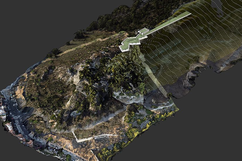
During the eighteenth century the Piedmontese government strengthens the walls of the city of Cagliari through a series of pentagonal bastions, horn works, ravelins and a series of minor buildings located in the hills that characterize the landscape context. Some of these buildings are designed by military engineers on the hill of Mount Urpino which is about 2 km from the walled city. The project involves the construction of some small forts well described in eighteenth and nineteenth century historical maps; this document are very interesting because they allow the architectural and dimensional analysis of the project. Some portions of these works are in an area of the urban park of Mount Urpino that has undergone major changes as a result of an intense quarry activity that continued until the middle of the last century. A photogrammetric survey with UAVs made it possible to identify some traces of the Piedmontese works, some of which are difficult to access due to the conformation of the site. Following an analysis of historical maps, a surface prospecting and a reconnaissance with the drone it was possible to develop some digital models of the southern sector of the hill and propose a first reconstructive hypothesis of the historical structures. These results are described through a selection of axonometric and zenith views, environmental and orthophoto sections. The investigation has therefore allowed to define a first step of research aimed at the knowledge, protection, and enhancement of the historical military landscape. Starting from these results it is possible to design further analysis using geophysical methods, (the latter being useful for identifying structures located below ground level), and also to define a project to enhance a cultural itinerary that connects the identified structures located in panoramic places.
DOI: https://doi.org/10.20365/disegnarecon.29.2022.11
Keywords
Full Text:
PDFRefbacks
- There are currently no refbacks.
Copyright (c) 2022 Andrea Pirinu
DISEGNARECON
ISSN 1828 5961
Registration at L'Aquila Law Court no 3/15 on 29th June, 2015.
Indexed in SCOPUS. Diamond Open Access. All papers are subjected to double blind peer review process by qualified reviewers.
Journal founded by Roberto Mingucci